Audubon Vermont
Why Bird Conservation?
The Golden Chain Project (GCP), led by Audubon Vermont, utilizes Golden-winged Warbler (GWWA) conservation as a way to bring together multiple land trusts and potential bird partners around a common theme. The GWWA is a small, distinctively colored bird that has suffered sharp population declines range-wide due to young forest and early successional habitat loss. “There is a lot of [GWWA] habitat in people’s backyards. These are birds that you can look at out on your back forty,” says Mark LaBarr, Conservation Program Manager at Audubon Vermont. Local birds can create local buy-in. The GWWA acts as a fundraising and outreach mascot and a “golden compass” directing land trust conservation efforts.
Birds move through large areas, thus successful conservation efforts must be realized at a landscape scale. Western Vermont has the highest concentration of GWWA in the northeastern portion of the species’ range and nearly every breeding pair is on private land. GCP was able to identify, manage, and protect a chain of GWWA habitat patches in western Vermont, and in so doing, fostered collaboration between and increased the conservation capacity of regional land trusts.
Spotlight Resource: Bringing Land Trusts Together
The Golden Chain Project connects regional land trusts in the Champlain Valley through GWWA conservation. Partners include: Middlebury Area Land Trust (MALT), Charlotte Land Trust, Hinesburg Land Trust (HLT), Vermont Land Trust, and the Cornell Lab of Ornithology. “The partnership will help build capacity and recognition for the vital conservation work of land trusts in this region,” says LaBarr. Many local land trusts have small or volunteer staffing that may limit their conservation work. Audubon helps fill this gap by providing technical support to its land trust partners in identifying properties most suited to support GWWAs. Moreover, Audubon shows land trusts how they can use a key species, like GWWA, to secure habitat management funding. In return, land trusts provide Audubon with “broader outreach” to landowners as well as information on land trust holdings and parcels that provided GWWA habitat connectivity. Through coordinated efforts, GCP organized six well-attended public outreach events led by Audubon staff including talks, field and bird banding demonstrations, and habitat assessments. GCP also presented their data and mission to several regional land trusts at the Western Vermont Land Trust Collaborative Workshop and Audubon followed up individually with each organization to see how they could best share resources. While sometimes logistically challenging, congregating land trust members in the same room to consider scientific data and collective conservation goals proved instrumental in inspiring engagement.
The Power of Mapping
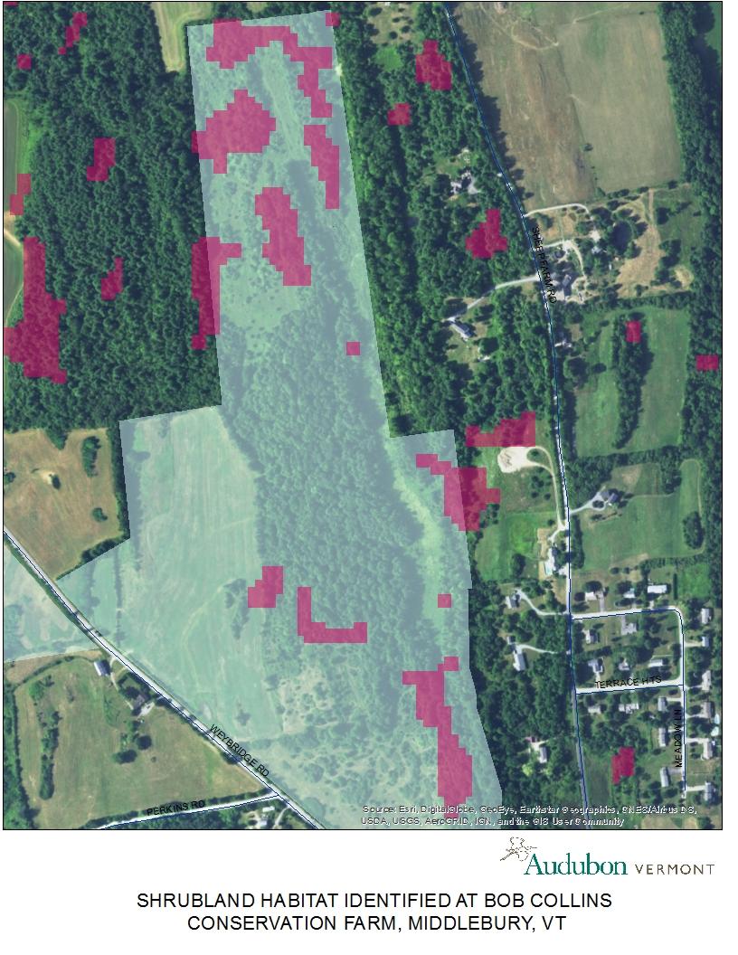
A major outcome from GCP was the creation of a geographic information system (GIS) map which displayed habitat type, parcel ownership, and eBird and Audubon surveys that showed presence or absence of GWWA in the region. GCP worked with local graduate student Steven Lamonde, from Antioch University New England, who had the GIS skills to build the map. This visual emphasizes the importance of creating connectivity in the region and helps tell the story of where to concentrate land protection and habitat management efforts for young forest and early successional habitats, as well as where to reach out to new landowners who may be potentially interested in creating habitat connectivity corridors.
Advice to Other Land Trusts
“The one thing that really worked well for us was the creation of a map identifying areas of either known or presumed GWWA habitat, and to use the map as a vehicle for working with land trusts to not only help them prioritize new parcels to preserve, but also to look at parcels they have already preserved to think about how to manage them.” The lesson here is visual tools are powerful. For GCP, the map acted as their visual to help convince and engage partners. In the world of science, data can sometimes be overwhelming and inaccessible. Numbers, statistics, and graphs can be challenging to understand. Having a partner develop and present concrete, easy to interpret visuals for target audiences may be an effective vehicle for community buy-in.
Next Steps
GCP has a core group of landowners with whom they are focusing their efforts. As those relationships strengthen, GCP expects to engage more land trusts, conservation commissions, towns, and NGOs in young forest management for GWWAs in the Champlain Valley. They also plan to expand their reach beyond the Champlain Valley through the creation of a GCP Story Map with funding from the National Fish and Wildlife Service.
The USFWS Partners Program continues to provide funding for GWWA habitat management at three land trust properties in the GCP. Audubon Vermont has also partnered with Vermont Fish and Wildlife Department, Wildlife Management Institute, and NRCS to enroll projects in The Young Forest Regional Conservation Partnership Program (RCPP). The RCPP provides funding for “technical and financial assistance to non-industrial private forestland owners who implement practices that result in an increase in the quantity and quality of young forest habitats.” Audubon is working to get projects from HLT and MALT enrolled in the Young Forest RCPP. These diverse funding sources ensure that the GCP will continue its important work.
GCP is an example of how multiple land trusts can come together, use visual mapping tools, and unify around the common goal of supporting a fragile species in decline.
Conservation Update
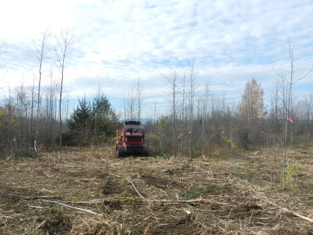
Audubon Vermont’s partnership with Vermont Land Trust (VLT) continues through a new project with Nordic Farms in Charlotte, Vermont . Audubon, VLT, and Nordic Farms are coming together to demonstrate effective integration of bird conservation and diversified agriculture through the Integrating Avian Conservation and Diversified Agriculture in the Champlain Valley of Vermont Project. The project is unique in its aim to rewild agricultural lands and include farmers in wildlife habitat conservation. With funds from the 2020 Cornell Land Trust Small Grant Program, Audubon and VLT plan to focus restoration on 50 shrubland acres through the removal of invasive species, plantings of native shrubs and trees, and installation of deer exclosures to demonstrate the impact of deer browsing. They will also increase monitoring efforts at the property through the creation of footpaths and an eBird hotspot to encourage local birders to submit their species observations on behalf of the land trust. This project is integrated into the Western Vermont Collaborative already operating in the Champlain Valley.