eBird Modeled Data
The eBird Science team uses state-of-the-art statistical models and machine learning to build visualizations and tools to help decision makers, scientists, and birders alike to better understand migration, abundance patterns, range boundaries, and much more. The team compiles raw eBird data and high-resolution satellite imagery from NASA, NOAA, and USGS into cutting-edge statistical models to predict population trends and to predict when, where, and in what numbers species occur every week of the year. Explore the pages below to learn more about eBird visualizations and tools.
 eBird Status and Trends
See seasonal abundance patterns that reveal migratory pathways and when and where species occur as well as where bird populations are increasing or decreasing at local and regional scales.
- State-level eBird Data Summaries
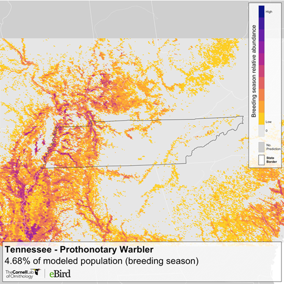
The eBird state-level data summaries are downloadable data products from eBird Status and Trends that provide summaries at a state level for relative abundance and population metrics.
- Download eBird Data
eBird has open data access products available in several formats that can be helpful in your strategic conservation planning, scientific modeling, and analyzing data from your land trust hotspots.
- eBird Abundance Maps
Abundance maps are a visual tool for land trusts to identify which species they should target on their properties and easements and strategize ways to manage lands to help reverse bird declines and improve habitat quality.
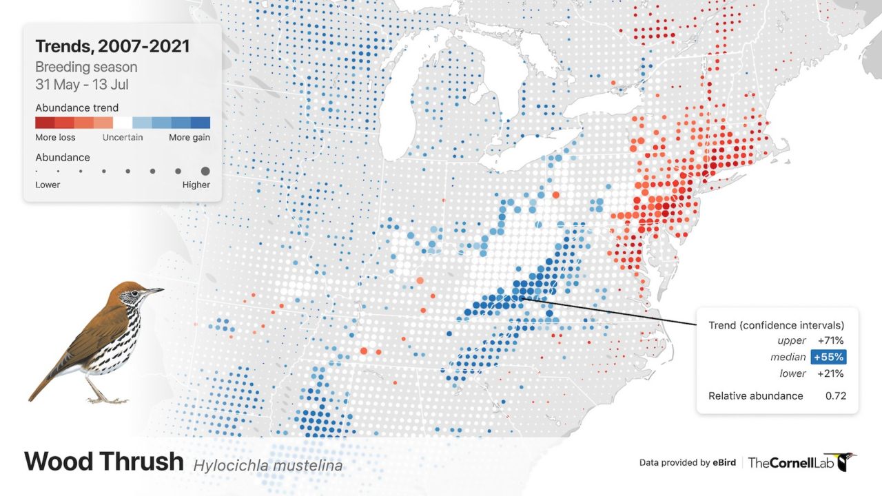
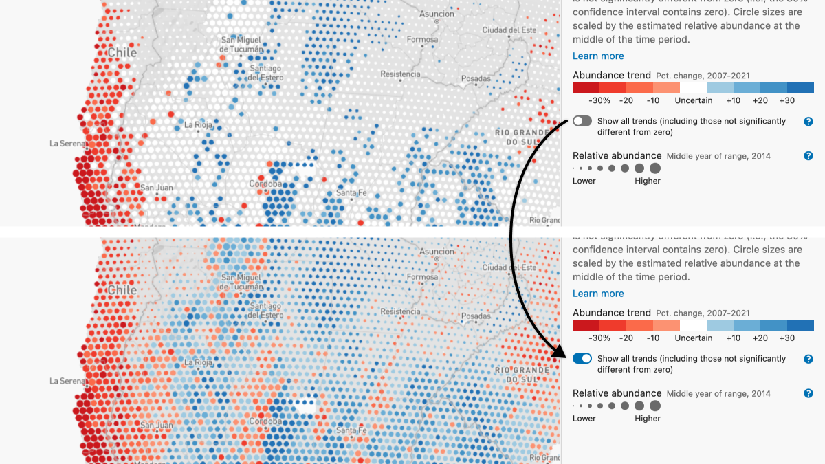
- eBird Trends Maps
A new generation of eBird Trends maps provides an unprecedented fine-scale view of where bird species are increasing or decreasing. eBird Trends maps show changes in bird abundance during different parts of a bird’s life cycle—a critical component that until now has been missing.
- Priority Breeding Bird Mapping Tool
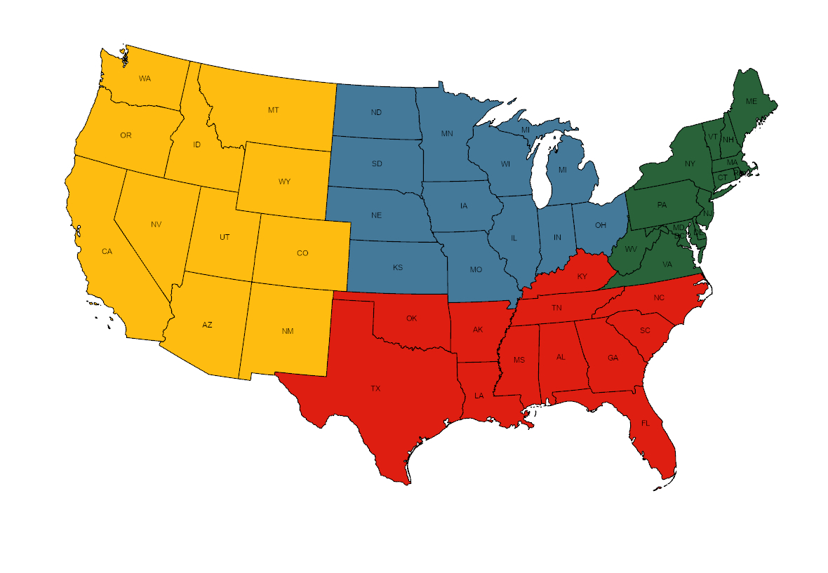
Four regional interactive mapping tools that display eBird Status and Trends data with strategic land conservation data layers to facilitate strategic land conservation, inform habitat management plans, and help guide landowner outreach and engagement efforts, all through the lens of bird conservation.


Sign up to receive our eNews and stay connected
The Land Trust Bird Conservation Initiative will send you updates about funding opportunities and ways to work with partners to protect birds and further your land conservation goals. We’ll highlight resources to assist with bird conservation on private lands, showcase tools and data visualizations to assist with planning and stewardship, and share success stories from the field.